
Pause the video above a few times as the drone gains elevation (particularly between 0:07 and 0:37). The color contrast in the vegetation below is not only neat to see, it's valuable from a management perspective.
Since very early on in this restoration project, I saw the value of a bird's eye perspective on the marsh. All the way back in July 2015 -- just after taking possession of the property -- a friend and neighbor of one of my brothers (who happens to be a professional videographer and drone enthusiast) offered to come "fly the property." The fifty or so photos and couple dozen short videos that we captured that calm Saturday morning were eye-popping then . . . and have been unbelievably useful ever since.
The raw footage above is one of my favorites. I particularly love the ~30 seconds of footage that starts at or about 0:07. Not only is the marsh incredibly beautiful when looking straight down starting from about 25-feet, the story that unfolds is extremely useful from a technical perspective. If you pause the video at 0:10, you start to see why I get so excited.
 |
| Bryan Ellis of TPS getting acclimated on our main West dike (pun very much intended) with the school's drone -- equipped with a thermal imaging camera |
As the drone gains elevation and the color contrast becomes more apparent, a trained eye can not only easily differentiate the color, it can also identify the plants! In this simplified case: dark green = broadleaf cattail (a desirable cornerstone plant in our region) and mint green = Phragmites (a monstrous invasive we are tirelessly trying to fight back). So in one ~1:30 video, we confirmed an initial hunch: drones can help confirm what we are seeing on the ground and offer a unique perspective to provide valuable management direction.
All of this makes a lot more sense when you realize that one of our primary tasks each summer is to "map" vegetative cover -- essentially, determine what's growing, where. This is important for a whole host of reasons. It can be done (and very effectively, I might add) the old fashion ways -- in the brain (through on-the-ground, in the wader, or in the punt boat) observation . . . that can then be transcribed to crude pencil sketches and field notes. And it can also be done in much more technical ways.
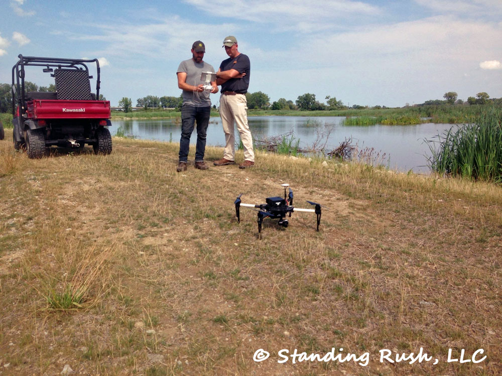
Yesterday, I hosted an instructor and friend from Toledo Public School's Natural Science Technology Center -- an established component of the new Aerospace & Natural Science Academy of Toledo (ANSAT). First and foremost, Bryan is an extremely passionate and enthusiastic person (which I love). He is also extremely talented and knowledgeable in a wide array of subjects that are very relevant to what we do at the marsh. One of his many talents: a drone pilot. So yesterday, we set two goals. First, we wanted to give Bryan a basic tour (somehow, this was the first time we were able to lure him out!), and secondly, we wanted to get the bugs worked out so that we could try using their program's extremely hi-tech "quad" to prepare a thermal fingerprint of the entire property. Each color will theoretically help us map individual plant species.
 |
| Vegetative polygons overlayed atop an aerial of the marsh; in this case, red would mean spray and green would mean don't spray |
We did this back in 2015 (combining my brother's friend's traditional drone images and the old fashion ground-truthing techniques) and it worked pretty darn well. We're going to see if we can improve on things with this fall's spraying campaign via our collaboration with TPS. Thank you, Bryan! Should be fun!!