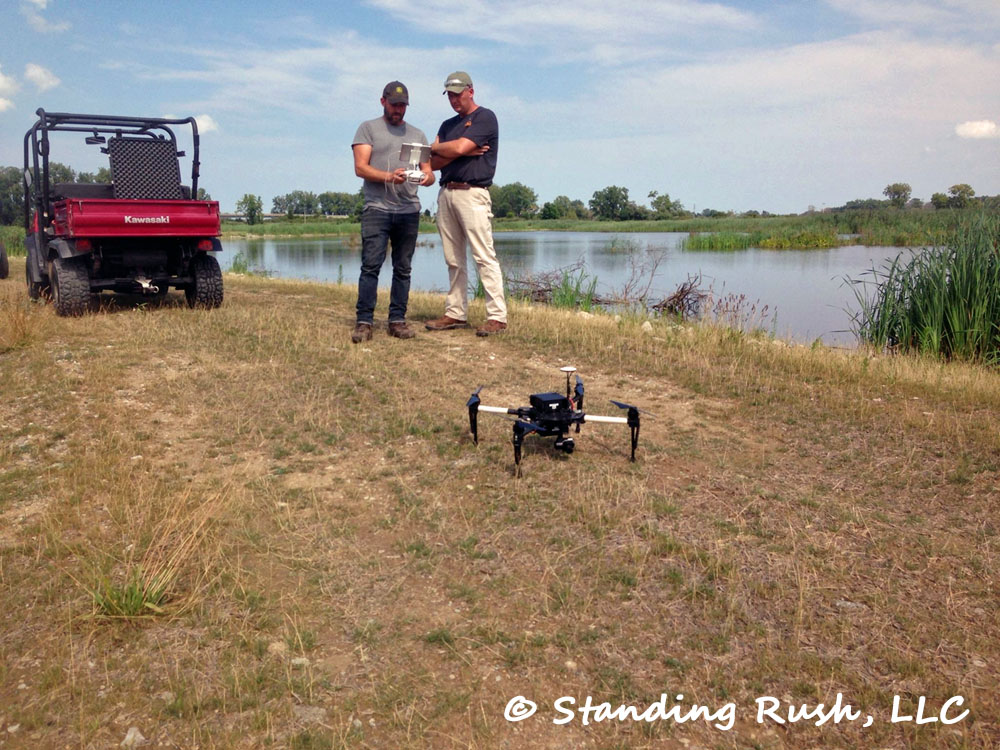
Showing posts with label drone. Show all posts

Friday, July 5, 2019

Another Critical Improvement Project

Our drone's perspective of work in progress late last week, about five solid days into digging

For the second time in as many major projects, our excavating contractor proved us wrong. On both occasions he estimated the heavy lifting of their work would be completed in 7-10 days, on both occasions we were skeptical (at best), and on both occasions he got the job done -- both done well and on schedule. Seeing the long-reach excavator almost to the bay going into the holiday weekend has provided even more reason for celebration this 4th of July.

As with the last project (completed in 2016), this is a major victory for the broader project. And also as with the last time, the scope of the project involved the complete rehabilitation of ~3,000 linear feet of interior earthen berm (or "dike") on our West Marsh.

Makeshift repairs like this one were becoming more and more
frequent going into this spring; it will be nice to give the shovel
a rest and not have to go on daily patrols looking for leaks
This project quickly moved up the priority list as the water levels in the lake and bay continued to climb. We really started thinking about the need for this work in 2017. As repairs became more frequent in 2018, we started laying the groundwork from a permitting and funding perspective. But as water levels continued to press higher, it became evident that this really needed to be a 2019 project. It had reached emergency status.

We call this levee an "interior dike" (as opposed to a bay-front or lake-front "exterior dike") because under normal circumstances, it would be. But sustained historically high water levels in Sandusky Bay have backed water up on a neighboring property and in so doing exposed us to sustained water pressures that the original dike was never built to withstand. As a result, we leaked -- early and often through much of this spring. And the situation created a snowball effect that wasn't good for our near-term or long-term management goals.

Excessively high water on the neighbor's side of the dike meant one of two things. Either (1) we conducted business as usual on our side -- with lower water levels in the main West Marsh and sometimes daily breaches from head pressure differentials that were greater than the dike could withstand, or (2) we held our main West Marsh higher than we wanted (from a habitat development and broader earthen infrastructure perspective) to reduce the pressure and likelihood of regular leaks and blow-outs. Neither situation was ideal, but that's been the reality, really for the last couple growing seasons.

This image highlights the first couple days of
digging and the quality of the clay we found,
visible by the teeth marks of the excavator
seen in the lower-right (click to enlarge)
Fortunately for us, we had local knowledge that the clay we needed was available on site -- in fact, directly adjacent to the existing dike. Roy reminded me early on in this project that if there is high ground in a coastal marsh, there is usually deep water nearby. But fortunately for us, the "deep" water nearby (the channel from which the clay was excavated to build the original dike) wasn't too deep. And also fortunate for us, there was an ecological driver to dig the adjacent channel deeper.

The premise is this: by digging the channel deeper we accomplish two goals -- (1) we harvest the clay needed to rehabilitate the earthen berm over its original "footprint" in the marsh, and (2) we create deep-water habitat (8-10' deep) that will allow a broader diversity of fish species to survive weather extremes within the marsh . . . both extended heat spells in the summer and prolonged ice cover in the winter. This minimum depth tends to provide critical refuge from what would otherwise be fatally low dips in available oxygen. And it was this win-win that allowed us both to get the original permit from the US Army Corps of Engineers (USACE) and to begin the project before the typical July 1 start date. (The Corps and affiliated agencies typically restrict all "in-water" work through June to protect fish spawning, but in our particular case, the risk of waiting outweighed the risk of starting a couple weeks early, so we were granted a waiver.)

The first day of digging from another perspective (I'm standing on the far left of the new pile of clay for scale); we really
didn't know what the quality of the clay would look like until we started to dig -- we've been pleased from start to finish

This image depicts what ended up being the final day of excavation (before clay was "put up" onto the dike); with the muddy
bay water to the left and in the background, it serves as a stark contrast to the clear, stable water within the marsh (right)

Now that we are 95% finished with the excavating portion of the project, the risk of leaks or blow-outs is dramatically reduced. We will now wait for the excavated clay to de-water and dry, hopefully over the next couple/few months, and then the contractor will bring in a dozer to level the "crown" (top of the dike) and reshape the side slopes. By this time next year, we should be able to drive a pickup truck all the way around the West Marsh. This will be a first since we took possession of the property in 2015 and will probably afford the best access this site has seen since at least the 1980s.

One more fun perspective of this most recent work from the sky -- this one taken by ODNR
Division of Wildlife Private Lands biologist Mark Witt from the agency's helicopter;
two important notes: (1) Private Lands will once again be supporting this project financially --
which is immensely helpful, and (2) notice the water covering nearly all of the farm ground
on the very top of the page . . . absolutely amazing


The long-reach in action -- each bucket could be placed in 20-30 seconds

Wednesday, March 20, 2019

A Ribbon of Limestone (From the Sky)

Newly placed limestone reinforces the main exterior dike (center) protecting the main West Marsh (left)
from the open bay (right) 
To close the loop on our most recent improvement project -- and to provide another perspective on the impact of historically high water on Lake Erie and Sandusky Bay -- I decided to get the drone in the air. [Call me a fair-weather pilot, but conditions were about perfect yesterday for a late morning flight in March!]

The image above does a nice job depicting the breadth of our recent stone work -- a little over 1,200 linear feet in all. And if you click on the image to enlarge you can also see how sustained high water and freeze/thaw cycles on the bay accelerated the erosion of the "barrier island" that (until very recently) seemed to provide real protection for the exterior dike. Ice came off the main bay just a few days ago -- probably once and for all for this season -- but the damage to the trees and shrubs that have been growing on the outer fringes for more than 25 years had already been done. Thank goodness we got that stone in place. The next few months of high water, which typically peak in early summer, are going to be interesting . . .

Modest waves are still relentless against what's left of our barrier island; the day the ice finally receded,
we could see that the damage had been done

Upturned root masses will not last long against high water and spring wave action; this portion of the barrier island would
have been two to three feet out of the water as recently as 2015 -- water levels are cyclical (and at times destructive)
on Lake Erie and the rest of the Great Lakes


Monday, February 25, 2019

Structure 1: A View From Above

The view from atop our newly constructed water conveyance structure (looking south/southwest); most of the field of view is of the
~40-acre "Rest Pond" (restored starting in 2016) -- the main ~145 acres of our "West Marsh" lies just beyond the open water toward
the top of the shot, and Sandusky Bay wraps this perspective to west (right) and to the north

Well, I finally got my drone in the air over the marsh! I beat this past weekend's crazy winds and took to the sky late Friday afternoon. Lighting was harsh, but the images still provide decent perspective. All were captured just above our recent construction site.

Our new pump and water conveyance structure ("Structure #1") from just inside the marsh, looking west/northwest
(the water on the top half of the image is what we call the "estuary" because it is directly tied to Sandusky Bay where
the cluster of trees jut from the water in the upper left of the image; the highway visible on the upper-right is Route 2)

Similar vantage point, facing more or less due west (image provides good overview of estuary, good view of access
to the open bay, and the winter vegetation within the Rest Pond)

Structure #1, the Rest Pond, and the Main West Marsh from the estuary/bay side of the newly constructed
water conveyance structure

We look forward to gathering more imagery from above -- not only of this project but of other restoration efforts around the property. Check out this post to read more about the many benefits of an aerial perspective.


Thursday, August 9, 2018

A Different Type of "Quad" (This Ain't No MULE!)


Pause the video above a few times as the drone gains elevation (particularly between 0:07 and 0:37). The color contrast in the vegetation below is not only neat to see, it's valuable from a management perspective.


Since very early on in this restoration project, I saw the value of a bird's eye perspective on the marsh. All the way back in July 2015 -- just after taking possession of the property -- a friend and neighbor of one of my brothers (who happens to be a professional videographer and drone enthusiast) offered to come "fly the property." The fifty or so photos and couple dozen short videos that we captured that calm Saturday morning were eye-popping then . . . and have been unbelievably useful ever since.

The raw footage above is one of my favorites. I particularly love the ~30 seconds of footage that starts at or about 0:07. Not only is the marsh incredibly beautiful when looking straight down starting from about 25-feet, the story that unfolds is extremely useful from a technical perspective. If you pause the video at 0:10, you start to see why I get so excited.

Bryan Ellis of TPS getting acclimated on our main West dike
(pun very much intended) with the school's drone --
equipped with a thermal imaging camera
The individual sprig of mint green among the sea of dark green is a hint. (Sorry, I'm a guy, so my color palette is a bit more limited than an Eddie Bauer catalog. I digress . . .)

As the drone gains elevation and the color contrast becomes more apparent, a trained eye can not only easily differentiate the color, it can also identify the plants! In this simplified case: dark green = broadleaf cattail (a desirable cornerstone plant in our region) and mint green = Phragmites (a monstrous invasive we are tirelessly trying to fight back). So in one ~1:30 video, we confirmed an initial hunch: drones can help confirm what we are seeing on the ground and offer a unique perspective to provide valuable management direction.

All of this makes a lot more sense when you realize that one of our primary tasks each summer is to "map" vegetative cover -- essentially, determine what's growing, where. This is important for a whole host of reasons. It can be done (and very effectively, I might add) the old fashion ways -- in the brain (through on-the-ground, in the wader, or in the punt boat) observation . . . that can then be transcribed to crude pencil sketches and field notes. And it can also be done in much more technical ways.

Yesterday, I hosted an instructor and friend from Toledo Public School's Natural Science Technology Center -- an established component of the new Aerospace & Natural Science Academy of Toledo (ANSAT). First and foremost, Bryan is an extremely passionate and enthusiastic person (which I love). He is also extremely talented and knowledgeable in a wide array of subjects that are very relevant to what we do at the marsh. One of his many talents: a drone pilot. So yesterday, we set two goals. First, we wanted to give Bryan a basic tour (somehow, this was the first time we were able to lure him out!), and secondly, we wanted to get the bugs worked out so that we could try using their program's extremely hi-tech "quad" to prepare a thermal fingerprint of the entire property. Each color will theoretically help us map individual plant species.

Vegetative polygons overlayed atop an aerial of the marsh;
in this case, red would mean spray and green would mean don't spray
I am running low on steam myself right now, so I'll have to elaborate on this on a future post. But the punchline is we need to prepare a visual similar to the one above within the next few weeks. Each shaded "polygon" will correlate to a unique string of coordinates that can then be uploaded into an on-board computer to guide a helicopter as it systematically sprays only the areas we shade and tell the computer (and linked sprayer) to mist with herbicide. The areas could be a couple hundred square feet up to several acres in size over the 500+ acre site.

We did this back in 2015 (combining my brother's friend's traditional drone images and the old fashion ground-truthing techniques) and it worked pretty darn well. We're going to see if we can improve on things with this fall's spraying campaign via our collaboration with TPS. Thank you, Bryan! Should be fun!!


Wednesday, April 5, 2017

An Invitation to "Get Into the Weeds" and Make Suggestions


As the spring rain returns and April snow lurks in the forecast, here's another taste of summer. The raw footage above was taken via drone in July 2015 -- just a few months after we took possession of the property -- by a brother's friend and neighbor who happens to be a videographer for public television.

While each snippet he took that day was more exciting to view than the last, this is one of my favorites. As the camera pans down and then gains altitude over the first 30 seconds, the distinction between individual stems of light green Phragmites and dark green cattail (a more desirable) is clearly evident. (More on the cattail story later . . .)

This visual distinction ended up being an incredibly helpful realization from a management perspective as we first delineated vegetative cover over the entire 600-acre site. Once we had the Phrag identified by air, we could compare it to the most recent Google Earth flyover, compare that to our ground-truthing in the field, and then confirm discrete areas that were infested with a monoculture of the noxious reed. I can say with a good deal of confidence that 90%+ of the Phragmites stems that appear in the video above were safely and efficiently sprayed and killed just a couple months after this footage was recorded. Pretty stinkin' awesome. Again, more on that later . . .

This video came to mind this morning for two reasons: (1) it helps provide some visual context of large portions of the West Marsh at least, and (2) I love how it feels like it puts the viewer "in the weeds" -- meaning, "into the details."

It was almost spontaneous, but yesterday marked the day that I introduced this online journal to a broader audience. I stepped beyond family and friends to begin to try to share it with a wider circle (largely via Facebook, LinkedIn, and a couple specific email groups). As we get further "in the weeds" together, I really want to know what you want to read more about. I have lots of ideas, literally dozens and dozens of short stories, I'd like to share with a photo or two and a few words. And I know our time in the field will offer a constant barrage of additional, currently unforeseen and spontaneous opportunities to share.

But I want to get a feel for what you are most interested in. If you have ideas, feel free to include them by clicking "Post a comment" below, or if you are more comfortable, I'm happy to receive feedback via email (see "Contact Us"). Thanks in advance for the suggestions!